
Trace a Jurupa Valley Street Address
A street search works best as a bounded parcel walk. Choose a road segment between two cross streets, note both sides of the road, and keep a separate line for each APN. The first question is not “who lives here?” but “which land unit does this address describe?” Jurupa Valley’s city and county maps can reveal a parcel even when a street label, corner location, or private-road number is inconsistent. The resulting APN becomes the bridge to ownership, title, permits, and lawful voter-status channels.
- Address to APN. Locate the address in the Riverside County property portal or a GIS viewer and record the parcel number, situs, subdivision reference, and any displayed mailing field.
- APN to owner. Compare the parcel card with the disclosed owner information, assessed values, and property characteristics. Keep the physical situs and an owner mailing address in separate columns.
- Owner to deed. Use the current owner and legal description in the Riverside County ACR recorded-document index. Search the deed date and party role instead of treating the recorder as an address database.
- Deed to lawful voter channel. For an individual’s own registration, use the identity-specific California voter-status service. A voter file is not a public street roster, and a status match does not reveal a ballot choice.
- Current clue to older household. Ask the regional archive about reverse or criss-cross directories, then compare the address with census schedules, permits, and dated newspaper evidence.
The order prevents a common error. A deed can name a lender, trustee, corporation, or contractor without identifying a household. A permit can date work without dating a move. A directory can list one subscriber while missing another occupant. A street directory is strongest when every claim is labeled by source, date, and role.
Note: Keep a dated ledger for each parcel so a later owner, permit applicant, or mailing address does not overwrite an earlier household clue.
Jurupa Valley Address Records in One View
Jurupa Valley has no single public list that answers every street question. Riverside County ACR holds assessment, recorder, and clerk functions; the city holds its own post-incorporation planning and permit material; Riverside County election systems control voter-file access; and the library and archives hold the older address trail. Each record set answers a narrower question, so the table below keeps the evidence roles distinct.
| Record Set | Keeper | What It Shows | Access |
|---|---|---|---|
| Assessor parcel | Riverside County ACR | APN, situs, values, characteristics, and owner or mailing fields where displayed | Property portal or counter |
| GIS parcel map | Jurupa Valley and Riverside County | Parcel geometry, adjacent APNs, zoning, plans, districts, and overlays | Free interactive viewers; verify with the city |
| Recorded documents | ACR Recorder | Grantor, grantee, legal description, document type, date, and number | Free index; paid copies; counter or mail |
| Permit register | Jurupa Valley | Address, APN, project, contractor, license, value, and issued or opened dates | Accela for selected types and monthly PDFs |
| Planning and council files | City Clerk and departments | Applicants, owners, easements, lot-line work, decisions, and public comments | Record Library or CPRA request |
| Voter data | California SOS and Riverside Registrar | Defined registration fields for approved purposes | Identity lookup or restricted application |
| Criss-cross directory | Riverside Public Library archives | Listed address-to-occupant or telephone evidence for a published run | Archive inquiry and reading-room research |
The parcel number is the useful hinge between the first five rows. The street name helps orient a search, but the APN and legal description carry the title trail. A lawful voter channel and a reverse directory add people clues only within their own access rules. That division keeps a by-address result from becoming an unsupported claim about everyone at a property.
Jurupa Valley Property Search Fields
The Riverside County property portal is parcel-oriented. Enter an address or APN, inspect the returned situs and parcel facts, and note which owner or mailing fields the public interface actually displays. An unrestricted owner-name search was not verified on the public application, so a name-first assumption can send a street search in the wrong direction. Start with the location whenever possible.
| Tool | Entry and search method | Fields or layers returned |
|---|---|---|
| Riverside property portal | Address or APN; exact owner-name option not verified | APN, situs, assessed values, property characteristics, tax links, and owner or mailing visibility where permitted |
| Jurupa Community Development GIS | Map navigation and address or location search where the viewer supports it | Parcel boundary, zoning, General Plan land use, town-center and community-development overlays, specific plans, airport compatibility, and equestrian trails |
| Map My County | Address, APN, or place search, then pan, zoom, and identify | Parcel outlines and county thematic layers, with a parcel click used for comparison |
The Riverside County property portal is a starting point, not a household census. Preserve the portal’s search date and the roll year if shown. Exemption flags, when visible, can support an owner-occupancy question but do not identify all people who use the parcel.
For a broad street segment, compare the city viewer with Riverside County Map My County. Differences in boundary, zoning, or layer display are a reason to ask the city or county to verify the feature, not a reason to merge two parcel cards.
Jurupa Valley GIS Layers for Street Browsing
GIS makes a street search spatial. Search or zoom to the target location, click the parcel, and write down the APN before moving to the next lot. The Jurupa Valley Community Development map lists property, zoning, General Plan, overlays, specific plans, airport compatibility, equestrian trails, flood plains, parks, schools, and public-safety features across its viewers. The county map is a useful parcel-oriented fallback.
The Jurupa Valley GIS maps page shows the city’s available layer choices and cautions that displayed information should be verified with the city.
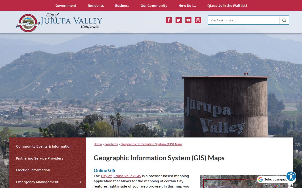
The GIS view helps catch corner parcels, rear lots, vacant land, and parcels that face a road without carrying the street number a reader expects. It does not identify household members. No official citywide radius or automatic neighbor export was verified, so parcel-by-parcel identification remains the reproducible method.
Note: Record both sides of a road segment and inspect private roads, rear parcels, and multiunit or condominium APNs before calling a street search complete.
Jurupa Valley Address Fields and Situs
A parcel is a mapped tax unit identified by an APN. It may contain one structure, several units, vacant land, or a larger development, so the parcel count is not a household count. The situs is the physical land or building being assessed. The mailing address is where an owner receives tax or other correspondence. A matching situs and mailing address can support an owner-occupancy hypothesis, but it does not prove who is present.
- Parcel
- The mapped property unit tied to an APN and assessment record. One parcel can hold more than one household or structure.
- Situs address
- The physical location assigned to the assessed land or building. It is different from an owner’s mailing address.
- Plat
- A recorded map that lays out lots, blocks, streets, or easements. It can connect an old legal description to a changing street label.
- Criss-cross directory
- An older reverse directory organized by address, often with an occupant or telephone entry for the years and places its publisher covered.
Apartment, condominium, and mobile-home contexts need extra care. One public parcel may cover many households, while separate units may have their own APNs. A corner lot may use the intersecting road for its situs. A vacant parcel may have no conventional street number. Use the map geometry, recorded map, and legal description before joining records.
Property-owner myth. A tax mailing address is evidence about an owner’s contact point, not a public declaration of everyone who lives at the Jurupa Valley situs.
Jurupa Valley Deeds Behind Each Address
The recorder index is keyed to parties, dates, document classes, and legal references rather than a simple street-address box. Translate the address into an APN, current owner, and legal description first. Then search the current owner as grantee for the acquisition deed, read the seller as grantor, and move backward through the same legal description. A deed shows a recorded instrument and title event; it does not list every occupant.
The Riverside ACR advanced document search supports the recorded-party route. Enter an individual as LAST FIRST MI without punctuation, try a last name with a first initial when needed, and keep organization spellings separate from people.
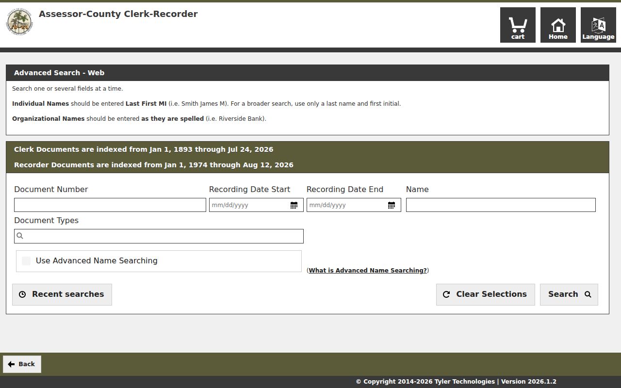
| Advanced field | Use in an address trail |
|---|---|
| Document number | Retrieve a known recorded instrument without reopening a broad name search. |
| Recording date start and end | Limit the search to the likely transfer window using mm/dd/yyyy. |
| Name | Search an individual in LAST FIRST MI form or an organization as recorded. |
| Document types | Narrow the class to deeds, trust deeds, releases, liens, maps, or another indexed category. |
| Advanced name searching | Use the checkbox or help option when name logic needs expansion. |
| Search type | Select Name, Document Number, Document Type, Map Type and Book/Page, or Advanced. |
Follow a quitclaim, trust transfer, reconveyance, or deed of trust with care. Those instruments can change the indexed parties without representing a conventional sale or a new household. The deed image and the legal description are the check against a same-name or same-number mistake.
Jurupa Valley Permit History by Address
Jurupa Valley’s Accela Citizen Access supports selected electrical service-changeout, residential HVAC, water-heater, reroof, and sign permits. Monthly issued-permit registers provide a useful alternative when an interactive browser session fails. The published register can include permit number, issued date, permit or project type, address, APN, description, license number, contractor, job value, and opened date.
Use the Jurupa Valley permits page for the city’s access route and supported permit types. The Accela permit portal carried an October 15, 2025 warning about a Chrome 500 error and suggested an updated browser or Edge, Firefox, or Safari.
The Accela entry view for Jurupa Valley permits is useful for connecting an address to a project record.
Keep the role attached to every name. A permit can identify an applicant, owner, contractor, license holder, or representative. It dates work and may expose a parcel or project description, but it does not establish who occupied the property or when a household moved.
Jurupa Valley Pre-2011 Street Records
Jurupa Valley incorporated on July 1, 2011 from established communities including Rubidoux, Mira Loma, Glen Avon, Pedley, Sunnyslope, and Jurupa Hills. Post-incorporation city council, planning, GIS, and Accela files form one municipal series. Earlier permits and planning material may be held under Riverside County or under the community name used before the city existed.
Search a historic street with both its current city label and its older community label. The Jurupa Valley Record Library can expose deeds and easements, lot-line adjustments, right-of-way dedications, ordinances, resolutions, agreements, and planning packets. If the item is absent, ask the City Clerk for an identifiable record or use the city public-records request form rather than assuming a missing web result means the record was destroyed.
No authoritative citywide street-renumbering year was located. When a road name, number, or jurisdiction appears to change, compare the subdivision, lot and block, APN, legal description, historic map, and council or road record. That evidence is stronger than a similar number in a different community.
Jurupa Valley Recording Access: 1974 Line
Riverside County ACR places its sharpest online boundary at January 1, 1974 for recorder documents. County clerk documents reach January 1, 1893. A 1974-and-later deed trail can start in the free online index, but earlier instruments require office indexes, filmed books, archival assistance, or a FamilySearch catalog search. The cutoff marks an access change, not the end of the land history.
The Riverside County recording-services page lists counter, mail, phone, and online-copy channels.
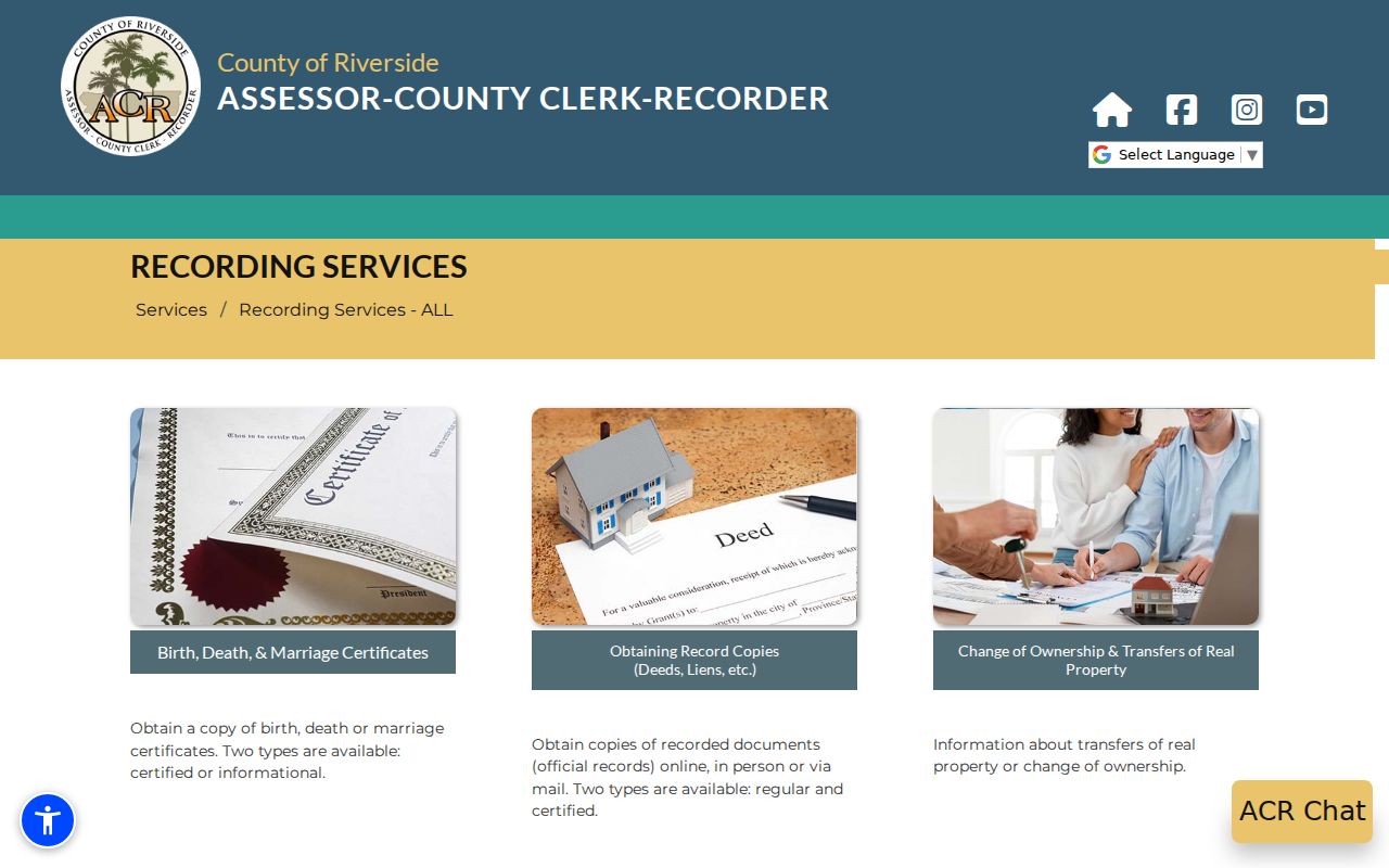
ACR copy orders cost $8 for the first page of each document, $1 for each additional page, and $2 per document for certification. The office states that there is no refund after copies are made. Phone assistance is available at 800-696-9144 or 951-486-7000 on weekdays from 8 to 5. A counter or mail request is the fallback when an older book or an image is not available online.
Note: Save the last online legal description and party names before moving to pre-1974 books; those details make a counter request precise.
Jurupa Valley Criss-Cross Street Sources
Older occupants are more likely to appear in a reverse or criss-cross directory than in a current parcel record. Exact Jurupa Valley and Riverside-area year runs were not published in the available official sources. Riverside Public Library Local History Archives at 3900 Mission Inn Avenue holds regional directories, maps, indexes, and related local-history material. Staff can answer a holdings question, and the reading room lists Tuesday through Thursday hours of 2 to 6, Friday and Saturday hours of 2 to 5, and Sunday by appointment.
Ask for Polk, Riverside County, telephone, rural-route, reverse, or suburban directories that include Rubidoux, Mira Loma, Glen Avon, Pedley, or Sunnyslope. At the volume, record the title page, coverage statement, publisher, abbreviation key, page, and whether an entry is residential or business. A “no return,” vacant, rear, apartment, or under-construction notation is useful context, while absence from one volume is not proof that a person had left.
Press-Enterprise microfilm can be requested through California State Library interlibrary loan, and the archive accepts obituary research requests at 951-826-5301. The collection details and reading strategy belong with the Jurupa Valley city directory collections; the street question is how one address is tested against those volumes.
Jurupa Valley Voter Lookup Limits
California’s My Voter Status service asks for a first name, last name, date of birth, and additional identifying information such as a driver license or partial Social Security number when the portal requires it. A match can confirm registration status, party preference, polling place, and election context for the individual. It does not expose ballot choices, and it is not a browsable list of every voter along a road.
The California voter-status lookup is the correct self-verification channel. Riverside County election information is available through the Registrar of Voters. Elections Code §2194 and 2 CCR §§19001-19013 limit voter-file access to defined election, scholarly, journalistic, political, or governmental purposes. A full file requires an application and statement of permissible purpose. Protected voters and Safe at Home participants require address suppression.
For a street study, use aggregate precinct or district statistics when available. Do not convert an identity-specific match, party preference, or participation field into a claim about a household. The lawful channel answers one person’s registration question; it does not fill the gaps in a street directory.
Note: Voter participation history can indicate participation, but it never identifies how a person voted and should not be used as a casual neighbor list.
What Jurupa Valley Street Directory Cannot Show
A street directory cannot reveal every occupant, family relationship, visitor, utility customer, delivery recipient, or protected address. DMV residence information is restricted under the federal Driver’s Privacy Protection Act and state law. Utility and delivery records are not public substitutes. The assessor can show a parcel and disclosed owner or mailing fields; the recorder can show an indexed instrument; neither one proves who sleeps at the situs.
Safe at Home gives eligible California participants a substitute mailing address, and a public record request cannot be used to defeat that protection. A CPRA request can seek an identifiable, nonexempt city or county record, but it cannot force an agency to create a new household list or disclose material that another law protects.
Lawful personal use. Jurupa Valley address records can support genealogy, house history, civic research, and personal safety awareness. Do not use them to stalk, harass, intimidate, threaten, or bypass a protected-address program; California Penal Code sections 646.9 and 653.2 supply important anti-harassment boundaries.
When a question turns from a parcel to a specific person, use the narrower records channel and seek a second identifier. A cautious street result says what the source shows, what date it represents, and what remains unknown.