
Jurupa Valley ZIP Code Coverage
The city's 2025 public contracting document identifies two ZIP codes as the local Jurupa Valley set. That is strong city evidence, but it is not a USPS boundary map and it does not show that every address carrying a postal label lies inside the incorporated line. The ZIP code directory therefore begins with the city-listed set and treats delivery, neighborhood, and jurisdiction as separate facts.
| ZIP Code | Areas Covered | Post Office | Notes |
|---|---|---|---|
| 91752 | Western and northwestern Jurupa Valley, especially Mira Loma and vicinity | Mira Loma delivery identity | Compare the exact parcel with the incorporated city boundary. |
| 92509 | Central and eastern city areas, including Rubidoux, Glen Avon, Pedley, Sunnyslope, and Jurupa-area addresses | Rubidoux and Jurupa Valley delivery identity | City Hall, Glen Avon Regional Library, and Louis Robidoux Library use 92509. |
No city-listed PO-box-only or unique institutional ZIP was found. A postal city label can serve an address historically mailed as Mira Loma, Rubidoux, or another community without changing the parcel's legal jurisdiction. Treat 91752 and 92509 as the city-listed set, then confirm a particular address through USPS and GIS before attaching a resident or record to it.
91752 and Mira Loma in Jurupa Valley
91752 is the western and northwestern side of the local ZIP picture, with Mira Loma as the key historic delivery identity. Mira Loma is not a synonym for the entire incorporated city. It is a search term that can lead to older permits, directory entries, maps, and postal records that do not use Jurupa Valley.
When a person or address is associated with 91752, preserve both labels in the research note. Use the postal result to confirm how mail is addressed. Use the Jurupa Valley Community Development GIS or county Map My County to determine whether the parcel lies inside the city and which APN, zoning layer, or neighboring parcel applies. A ZIP match alone cannot answer that second question.
Historical records may also be filed under Riverside County or a community section rather than a city section. This matters for directory research, pre-2011 permit records, and any request that names a public office. The record custodian follows the date and jurisdiction of the event, not the label printed on a current envelope.
92509 Through Rubidoux, Glen Avon, and Pedley
92509 covers the central and eastern city-listed set. Research terms should include Rubidoux, Glen Avon, Pedley, Sunnyslope, Jurupa Hills, and Jurupa Valley when a name, address, or older record is being traced. The postal label gives a useful first sort, but it does not turn those community names into one uniform neighborhood or records office.
Glen Avon Regional Library and Louis Robidoux Library use 92509, as does City Hall. That makes the ZIP useful for routing a local visit, while the office's record type still controls access. A city permit, county deed, library history item, and voter record can all carry different dates, fields, and restrictions even when the delivery ZIP is the same.
Keep Rubidoux and Robidoux distinct. Rubidoux is the community label. Robidoux is the person and library spelling. Search both where catalog, OCR, or local-history material is involved, but do not use spelling alone to merge people.
Jurupa Valley ZIP Code Search Fields
Most official tools do not offer a public “list every resident in this ZIP” button. The field set tells you what can be searched and what the result means. The recorder's advanced form has no ZIP field, and the public voter-status tool is identity-specific. The ZIP code directory is strongest when it explains those limits instead of filling them with an unsupported list.
| Tool | Search fields or mechanics | What the result can show |
|---|---|---|
| USPS ZIP Lookup | City and state or a specific address query, using the official delivery lookup. | Preferred delivery label and ZIP for the address checked. |
| Riverside ACR property portal | Address or APN; an unrestricted owner-name search was not verified. | Parcel, situs, valuation, tax links, and public owner or mailing fields where shown. |
| Jurupa Valley GIS and Map My County | Address, location, APN, place search, pan, zoom, and identify tools. | Parcel geometry, boundaries, APNs, zoning, overlays, and county layers. |
| ACR recorder index | Name, document number, date range, document type, map type, book/page, and advanced search. No ZIP field. | Recorded party, instrument class, date, number, and legal-description trail. |
| California ClaimIt | Last or business name or property ID; first name, city, and ZIP are optional filters. | Historical unclaimed-property matches, not current residence. |
| California voter status | First name, last name, date of birth, and portal-dependent identification or county/address fields. | One person's status and election context; not a casual ZIP or street roll. |
The Riverside County property search can begin with a situs address or APN. Once a parcel is known, the recorder search moves through party name and legal description. That translation from ZIP to parcel to party is the reliable bridge.
Jurupa Valley ClaimIt ZIP Filters
California Controller ClaimIt is one of the few official search tools in the research set that exposes city and ZIP as optional filters. A search starts with a last name, business name, or property ID. First name, city, and ZIP can narrow the matches. The filter may surface an older owner or a past address clue, but a matching unclaimed-property record is not proof that a person currently lives in Jurupa Valley.
Use the result as a lead. Record the property ID, name spelling, city, ZIP, and claim status shown. Then look for a separate ACR deed, probate, obituary, or business filing that can explain the date and role. Do not convert a city or ZIP match into a present-residence claim. ClaimIt is free, and the official claim process follows the selected property rather than an outside fee request.
A ZIP filter also has a narrower meaning here than a parcel map. It uses postal data associated with the unclaimed property record. It does not draw the incorporated Jurupa Valley line, identify a household, or reveal a protected address. If the filter returns a nearby postal city, keep that result labeled as postal evidence until GIS and the custodian confirm more.
The California Controller's ClaimIt search is the correct route for the optional city and ZIP fields. It should be paired with, not substituted for, county records.
USPS Labels and Jurupa Valley ZIP Lines
USPS answers a delivery question: how should a particular address be labeled and what ZIP is assigned to it? GIS answers a land question: where is the parcel, what APN identifies it, and which city, zoning, or planning layer covers it? The two systems can disagree in appearance without either record being wrong. A postal city may reflect a long-used community name, while the legal parcel sits in incorporated Jurupa Valley or outside its line.
Run the address through the USPS city and state lookup used for the Jurupa Valley ZIP code directory before relying on a delivery label. USPS also identifies its ZIP lookup authority for delivery questions. Then check the Jurupa Valley GIS maps and, when useful, Riverside Map My County. The city warns that GIS information should be verified with the city. A map click is a starting point, not a certified boundary opinion.
The USPS lookup captured for Jurupa Valley postal research shows the delivery side of that two-check method.
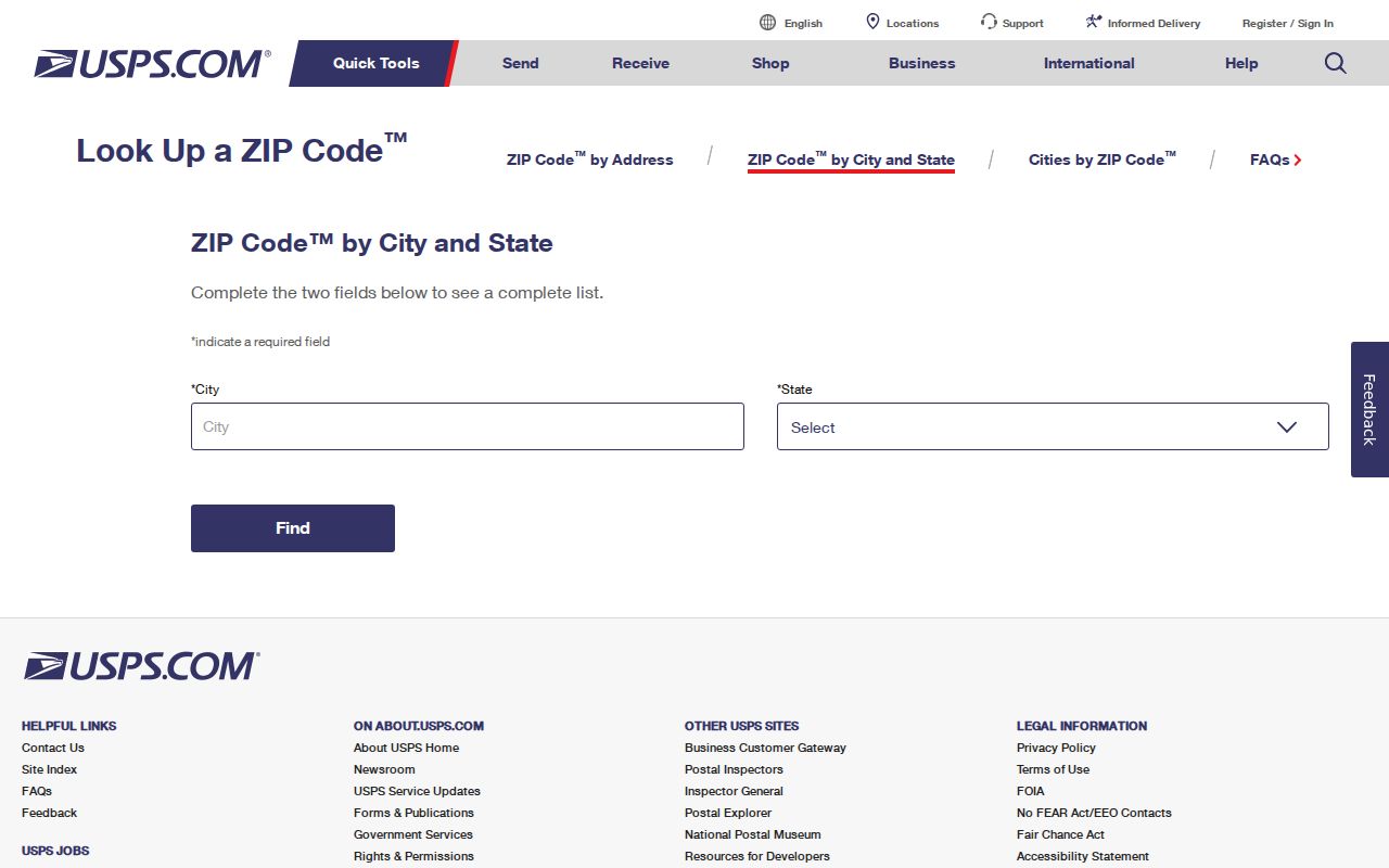
The image belongs beside the delivery check. After USPS supplies the postal answer, GIS and the assessor supply the parcel and jurisdiction answer.
Situs, Mailing, and Legal Description
Three address fields often get collapsed into one, which creates bad ZIP conclusions. A situs address identifies the physical land or building being assessed. A mailing address is where an owner receives tax or other notices and can be elsewhere. A legal description identifies the land by lot, block, subdivision, or metes-and-bounds language in the recorded instrument. They are related, but they are not interchangeable.
- Situs
- The physical parcel location used by the assessor and GIS.
- Mailing
- The address used to send owner or tax correspondence; it may be outside Jurupa Valley.
- Legal description
- The recorded land description that can preserve continuity when street labels or numbers change.
- ZIP plus four
- An extended delivery code that narrows a route or building; it does not create a city boundary.
- PO-box ZIP
- A postal code used for boxes or a delivery identity, not a mapped household parcel.
- Carrier route
- A delivery sequence used by USPS; it is not a neighborhood or ownership roll.
For a parcel search, begin with situs or APN. For a deed search, translate to party names and legal description. For a mail question, use USPS. For a voter question, use the identity-specific status channel and its legal rules. Keeping the fields apart is the central detail in any ZIP result.
92519 in the Jurupa Valley ZIP Directory
Some postal references associate 92519 with PO boxes connected to Riverside or Rubidoux, but 92519 was not included in the city's official 2025 local ZIP list for Jurupa Valley. The evidence is not strong enough to present it as a general city ZIP. Treat it as an address-level question only.
For a particular 92519 claim, enter the complete address into USPS lookup, note the returned delivery city and ZIP, then check the parcel in GIS. If the question concerns a record, ask the relevant custodian which jurisdiction and date range applies. Do not use a generic ZIP table to assign a person, parcel, or historical document to Jurupa Valley.
The uncertainty is itself useful. USPS delivery labels can change without an annexation, and a PO box can be a stable contact while the related person lives somewhere else. Record the query date and keep 92519 outside the definitive city-listed table unless official USPS evidence confirms its use for the exact address.
Pre-2011 Jurupa Valley Records by Community
Jurupa Valley incorporated on July 1, 2011 from established communities. A ZIP code does not change the custodian for an older event. Pre-2011 permits and planning materials may be Riverside County records. Older directories may use Mira Loma, Rubidoux, Glen Avon, Pedley, Sunnyslope, Belltown, or Jurupa Hills. Post-2011 city planning, council, GIS, and selected Accela permit records form a new municipal series.
The official Jurupa Valley history source helps establish the incorporation context, while GIS checks the parcel and the current city line. The postal label is only one field in that crosswalk. Preserve the historic community name in a request so the county or archive can route the record correctly.
This is especially important when a record is found through a ZIP filter. A 91752 or 92509 result may point toward the right delivery area while the actual record sits under a county office, an older community title, or an earlier parcel description.
Jurupa Valley ZIP Directory Workflow
A ZIP-wide search should narrow the question before it names a record. Use this order when the starting clue is a postal address or city label:
- Run the exact address through USPS and save the returned delivery city and ZIP.
- Open Jurupa Valley GIS or Map My County and confirm the parcel, APN, city line, and relevant layers.
- Use the assessor by address or APN, keeping situs and owner mailing fields separate.
- Translate the parcel to a recorded party and legal description, because the ACR recorder has no ZIP field.
- Use ClaimIt's optional city and ZIP fields only for historical unclaimed-property leads.
- Use voter status for an individual identity check, never as a casual ZIP or street roster.
Once a ZIP narrows the geography to a street segment, continue with the Jurupa Valley by-street address search. That next step follows parcels, deeds, permits, and lawful record channels rather than treating a postal boundary as a household list.
Boundary rule. USPS verifies delivery. GIS verifies parcel context. The record custodian verifies the event. Keep all three answers labeled.
The result is a defensible ZIP code directory trail: postal evidence first, land evidence second, and resident or historical evidence only from a source that actually records it.